
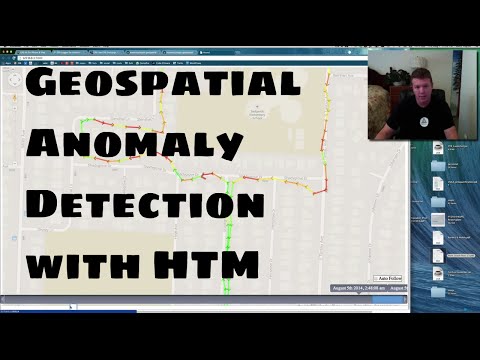
Geospatial anomaly detection app using NuPIC.
You must have NuPIC installed. Please follow the installation instructions there.
Now, install the other python requirements for nupic.geospatial:
pip install -r requirements.txt
To run, simply start the web server from the command line:
python server.py
This will start a web server and load some initial sample data for viewing. Open http://localhost:5000 in your browser to view and walk through the tracks.

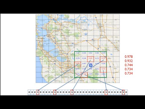
You can create GPS tracks with many mobile applications and GPS trackers. Any GPS data in the GPX file format can be loaded into nupic.geospatial (which runs it through NuPIC) and analyzed through the web browser. Here are a couple of popular apps you might use on your phone that produce GPX files:
- GPSKit (iPhone / iPad)
- GPS Logger (Android)
Converting GPX Files
You can convert one file or a directory full of GPX files into a format that is readable by nupic.geospatial. To do this, run the script as shown below:
./tools/convert_gpx.py <path/to/gpx/file/or/folder>
This will write out a file you can use as input for ./run.py (described below). For all options, run ./tools/convert_gpx.py --help
Now that you have converted your GPX files into the proper format for nupic.geospatial, there is another script to run them through NuPIC.
./run.py <path/to/input/csv>
The input file could be converted GPX data (see above) or the results from the route simulator in the web app (see below). This script will automatically create sequences base on the timing of the input rows. If you don't want this behavior, you can negate it with the --manual-sequence option, which will create sequences based upon the name field of the input CSV file. There are several other options available for this command. Run ./run.py --help to see them all.
After running this script, the output data will be written static/js/data.js, where the web server can load it into the browser. Now you can simply run python server.py to start the server and view your analyzed data.
You can experiment with different routes without a GPS device by using the route simulator. It will generate geospatial data and run it through NuPIC while the server is running. Simply open http://localhost:5000/simulate in your browser. Once you've created a route (or routes), you can either run them immediately through NuPIC with the "Build" button (at the top right of the screen), or you can save the tracks to a local file for running later with the run.py script (see above).
